
We have carried out many monthly drone video and aerial and ground photography over the past ten year, and they are among the most interesting work we do.
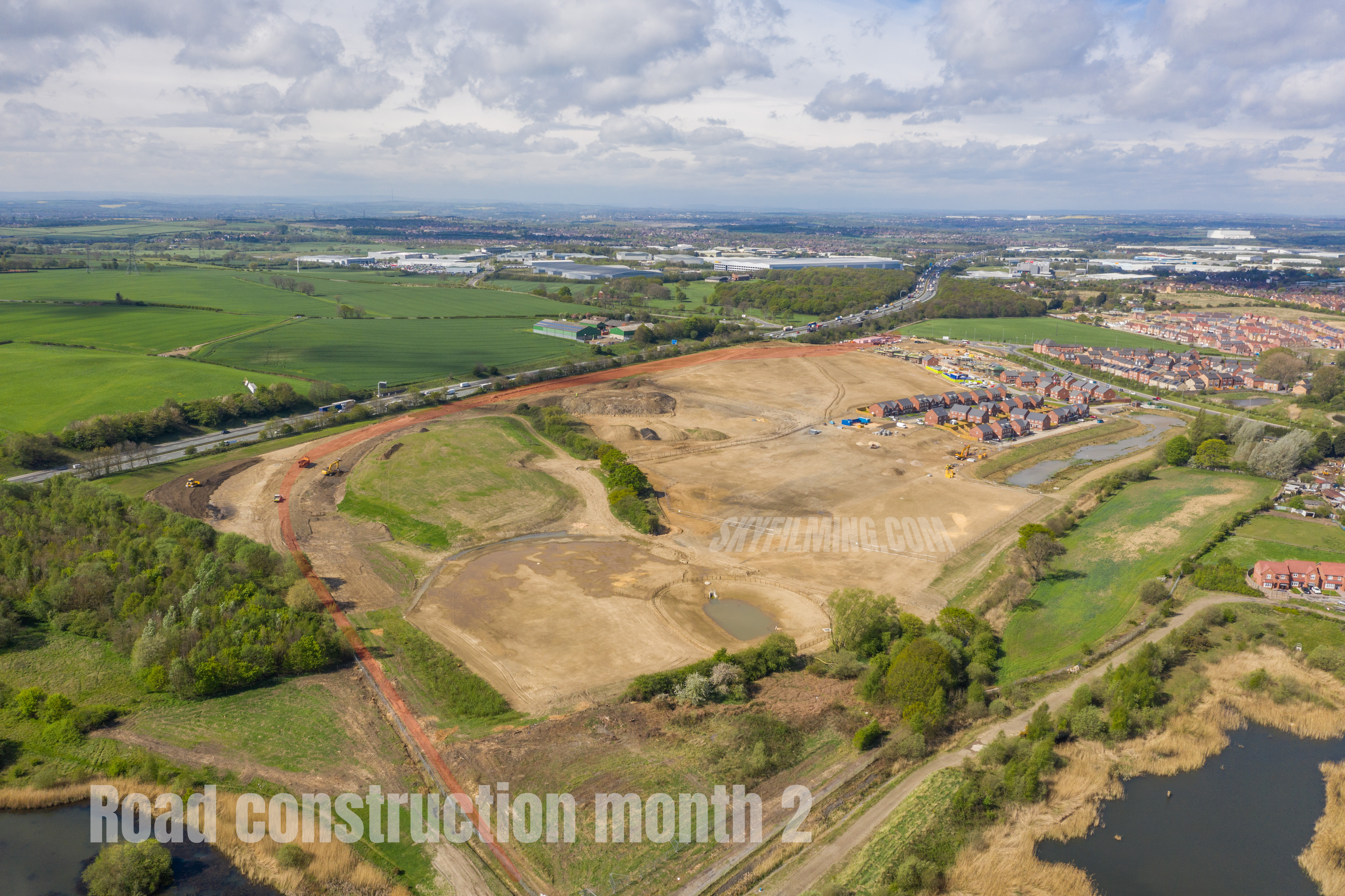
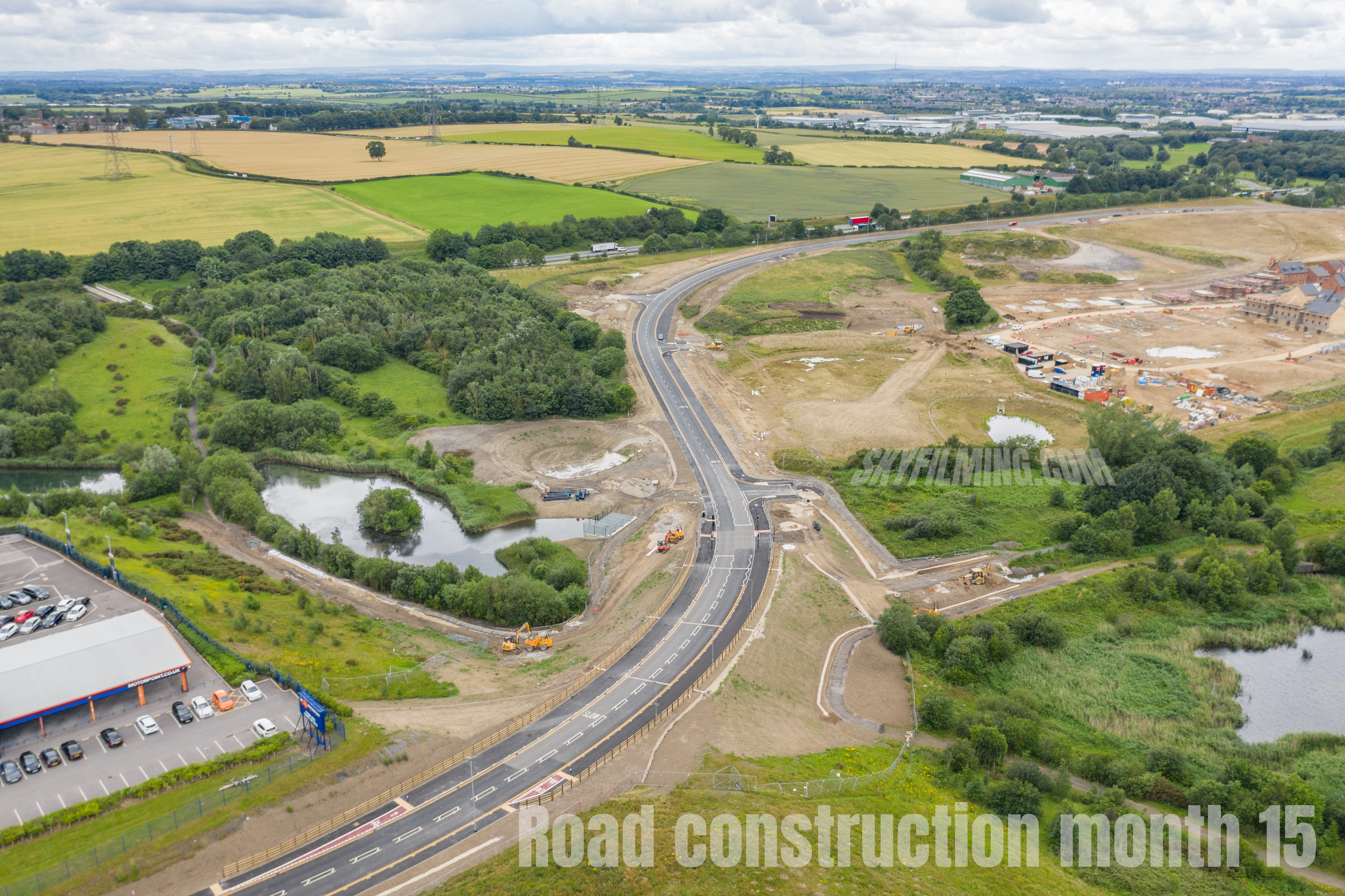
It’s a fascinating experience tracking the development of a building project, whether it be a large factory, a power station or, in this case, a new road built by Tarmac near Castleford in West Yorkshire.
For this assignment, which finished a couple of months ago, we visited once a month for 15 month, taking aerial photos and video clips each time, and also creating an aerial mapping survey.
The below video gives you an idea of what this drone mapping survey looks like, which is made from hundred of images stitched together into a hi res satellite style image. The video doesn’t really show the level of detail in the actual images, which can be hundreds of megapixels in size. A fully measurable 3d model can also be created from the same data.
 07837 036 042

Leave a Reply