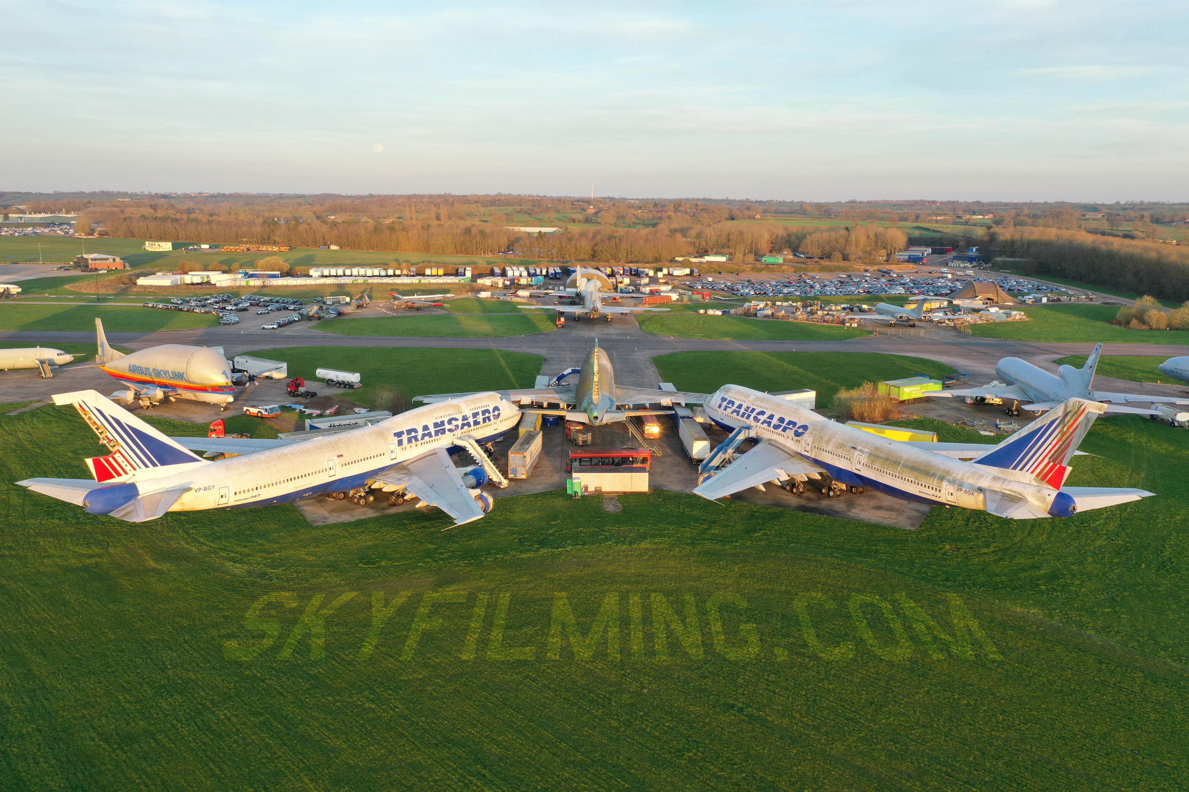
Bruntingthorpe is a huge old airfield near Lutterworth in Leicestershire that is now home to a thriving automotive business community, vehicle testing and proving ground and open air aviation museum.
All around the airfield runways, now a race track for testing cars and motorbikes, are buildings that house various businesses mostly connected to the automotive industry, including an enormous car action facility with tens of thousands of vehicles within the grounds of the site.
We were first asked to use our drones and ground based cameras to conduct a roof and wall survey of all the buildings on the entire site, some quite small and some staggeringly huge ex aircraft hangars. It took about two and a half days to use our roof survey drones to scan every inch and feature of all the buildings from above, as well as walk around on foot to photography the walls.
Our second task was to conduct a complete mapping survey of the entire area of the site with enough detail to see the state of the runway race track circuit surface, see all the cracks etc. We used a special drone for this and aerial mapping software to program the UAV to flying up and down in a lawnmower pattern, automatically taking overlapping images that could later to stitched together into a complete map, as well as individually inspected grid by grid by surveyors and engineers.
Even with the automated drone photography to map the massive airfield, over 4km long and 2km wide at the widest point, the task took three days to scan then a further week of processing photos and running them through mapping software on three computers. In all, the drones had capture over 20,000 individual images.This is our largest drone aerial mapping job so far, but it was a pleasure to work there amongst the amazing aviation history everywhere you look. There are fighter jets, huge military nuclear bomber jets, 747 jumbo jets and all kinds of related aircraft paraphernalia in random places. One of the best parts of the drone aerial photography and filming business is you get to see inside all these amazing spaces that many people don’t even know exist.
 07837 036 042

Leave a Reply